研究方向:多源遥感数据融合、雷达干涉测量技术InSAR、地质灾害监测、遥感图像处理、机器学习
办公邮箱:kuangjm@gpnu.edu.cn
个人简介:
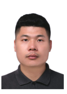
邝健明,博士,广东技术师范大学计算机科学学院专任教师。博士毕业于澳大利亚新南威尔士大学,测绘与地理信息工程专业。主要研究方向为多源遥感数据融合、雷达干涉测量技术InSAR、地质灾害监测、遥感图像处理、机器学习。在《Landslides》、《Remote Sensing》、《International Journal of Remote Sensing》、《Land Degradation & Development》和《Remote Sensing of Environment》等学术期刊,发表SCI/SSCI论文9篇;参与国内外科研项目6项,其中包括国家自然科学基金面上项目1项、广东省“珠江人才计划”引进创新创业团队项目1项,澳大利亚SMARTSAT CRC项目2项。
教育背景
2019-2023:新南威尔士大学,测绘与地理信息工程,工学博士学位。
2016-2019:新南威尔士大学,测绘与地理信息工程,工学硕士学位。
2012-2016:广东工业大学,测绘工程,工学学士。
工作经历
2024.12-至今:广东技术师范大学,计算机科学学院,讲师。
2023.12-2024.12:新南威尔士大学,土木与环境工程学院,助理研究员。
2021.08-2023.09:广东工业大学,土木与交通工程学院,科研助理。
学科领域
雷达干涉测量技术InSAR、光学遥感、遥感图像处理、地质灾害监测、机器学习
主讲课程
《神经网络与深度学习》
代表性科研项目:
1. 广东省“珠江人才计划”引进创新创业团队:“粤港澳大湾区湿地系统水质改善、生态修复与多维调控”—子课题1“湿地生态环境时空动态特征及影响因素”,2023/12至今,参与。
2. 国家自然科学基金面上项目: “多源时序雷达干涉形变信号数据集成与挖掘方法”,2023-2026,参与。
3. 澳大利亚新南威尔士州规划与环境部资助Australian Research Council (ARC) Linkage Project:“卫星合成孔径雷达监测矿区沉降与评估其对湿地环境的影响”,2023/07-2026/07,参与。
4. 澳大利亚SMARTSAT CRC Project P3.26: “利用卫星合成孔径雷达和其他卫星数据定量分析澳大利亚过往和现今的重大洪水灾害”,2022/09 – 2025/09,参与。
5. 澳大利亚SMARTSAT CRC Project P3.19: “利用卫星合成孔径雷达数据进行全天候近实时的森林火灾监测”,2021/09 – 2023/06,参与。
6. 澳大利亚Randwick Council: “智能街道停车”,2019/02 – 2021/01,参与。
7. 惠天九州,航天宏图,太原理工:“智能空间技术联合开发”,2018/07 – 2021/11,参与。
代表性论文:
1. KUANG, J., Ge, L., Ng, A. H.-M., Clark, S. R., Karimzadeh, S., Matsuoka, M., Du, Z., & Zhang, Q. 2024. Monitoring Slope Stabilization of a Reactivated Landslide in the Three Gorges Reservoir Region (China) with Multi-source Satellite SAR and Optical Datasets. Landslides. 1-21.
2. KUANG, J., Ng, A. H.-M., Ge, L., Metternicht, G. I. & Clark, S. R. 2023. Joint Use of Optical and Radar Remote Sensing Data for Characterizing the 2020 Aniangzhai Landslide Post-Failure Displacement. Remote Sensing, 15, 369.
3. KUANG, J., Ng, A. H.-M. & Ge, L. 2021. Displacement Characterization and Spatial-Temporal Evolution of the 2020 Aniangzhai Landslide in Danba County Using Time-Series InSAR and Multi-Temporal Optical Dataset. Remote Sensing, 14, 68.
4. KUANG, J., Ge, L., Metternicht, G. I., Ng, A. H.-M., Wang, H., Zare, M. & Kamranzad, F. 2019. Coseismic deformation and source model of the 12 November 2017 MW 7.3 Kermanshah Earthquake (Iran–Iraq border) investigated through DInSAR measurements. International Journal of Remote Sensing, 40, 532-554.
5. Tang, W., Ng, A. H.-M., Wang, H., KUANG, J., & Du, Zheyuan 2024. Surface Subsidence Characteristics and Causes Analysis in Ningbo Plain by Sentinel-1A TS-InSAR. Remote Sensing, 16, 2438.
6. He, Y., Ng, A. H.-M., Wang, H. & KUANG, J. 2023. Understanding the Spatiotemporal Characteristics of Land Subsidence and Rebound in the Lianjiang Plain Using Time-Series InSAR with Dual-Track Sentinel-1 Data. Remote Sensing, 15, 3236.
7. Zhang, Q., Ge, L., Zhang, R., Metternicht, G. I., Du, Z., KUANG, J. & Xu, M. 2021. Deeplearning-based burned area mapping using the synergy of Sentinel-1&2 data. Remote Sensing of Environment, 264, 112575.
8. Du, Z., Ge, L., Ng, A. H. M., Zhu, Q., Zhang, Q., KUANG, J. & Dong, Y. 2019. Long‐term subsidence in Mexico City from 2004 to 2018 revealed by five synthetic aperture radar sensors. Land Degradation & Development, 30, 1785-1801.
9. Karimzadeh, S., Matsuoka, M., KUANG, J. & Ge, L. 2019. Spatial prediction of aftershocks triggered by a major earthquake: A binary machine learning perspective. ISPRS International Journal of Geo-Information, 8, 462.
位访问者!

